
ROAD CONDITIONS AT DESERT CAMP

During our 6 weeks of Desert Camp we will have a wide variety of road conditions. We have been riding on these routes for years and they have been refined to offer the best cycling routes in the area.
Historic Towns and Hotel Week
Our route heads south to Tubac the first day through Green Valley. We ride many popular two lane roads used by local bike clubs on Sunday morning but we do ride 2 miles on Interstate 19 past the border inspection station. This interstate section has a good 7 foot shoulder.
The next day we have an easy ride from Tubac to Patagonia. We are on Arizona Rt. 82 for half of the day which has an okay shoulder but there are a few semi trucks that use this route as a connector from Nogales to Benson to avoid Tucson. So you will need to pay attention to passing truck traffic.
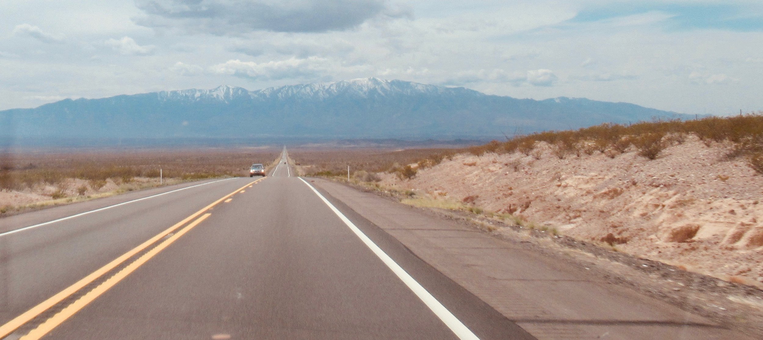
The third day we have a 12 mile gradual climb to Sonoita on Route 82 which has a good shoulder most of the time but there are still a few semi trucks. So you will need to pay attention to passing truck traffic. During the next 15 miles we loop around on back roads through the wine and ranching region. The next 11 miles we rejoin Route 82 which is mostly a downhill ride to lunch (again with a few semi trucks and no shoulder). Once we cross Arizona Rt 90 at the traffic light the trucks turn north and the remaining 9 miles is much quieter down to the San Pedro River. After lunch there is a final 8 miles climb into Tombstone with less traffic.
On the fourth day we ride downhill on Charleston Road toward Sierra Vista. Then south across the valley and around the backside of the mountains. A 4 mile section of Molson Road is a little busy but last year the county was marking it so we are thinking that it is repaved with an improved shoulder. (We are checking on that) Our final road toward Bisbee has a large shoulder and steady traffic. We come up past the mining area in Bisbee with a steep 2 mile climb into town.
Our fifth day heads up Mule Pass from downtown Bisbee. This is a steady 5-9% grade for five miles to the summit. The downhill on Route 80 is smooth and fast with a good shoulder. We head north through Tombstone again and then head west to Kartchner Caverns for lunch and an afternoon cave tour. The final 12 miles to Benson are fast and downhill with a good shoulder on Route 90. This day has moderate traffic.
Our final day back to Tucson is about 50 miles. The first 7 miles we climb out of town on side roads up the bluffs. Then we get on Interstate 10 for the next 13 miles which has been repaved with a wide smooth shoulder. At the 20 mile mark you start riding the frontage road (bumpy) for 10 miles to the outskirts of Tucson. The final 20 miles are on an assortment of streets with bike lanes and the final 10 miles are on a bike trail across town.
Century Weeks (2 and 4)
Our route heads south the first day through Green Valley. We ride popular two lane roads used by many bike clubs on Sunday morning into Nogales. We do ride 2 miles on Interstate 19 past the border inspection station. This interstate section has a good 7 foot shoulder.
The next day we have a scenic ride through Patagonia onto Sonoita. We are on Arizona Rt. 82 for half of the day which has an okay shoulder but there are a few semi trucks that use this route as a connector from Nogales to Benson to avoid Tucson. So you will need to pay attention to passing truck traffic.
In Sonoita, the next 15 miles we loop around on back roads through the wine and ranching region. The next 20 miles are on Route 82 again (Watch for trucks - no shoulder). It is mostly downhill to lunch in Huachuca City. You will have the option to stop by the Fort Gate to get your access pass to ride through the Fort later in the week. Only American citizens can get access passes but sometimes a US veteran can get foreign riders into the fort).
We will spend the next four nights in Sierra Vista and ride 60-100 loops everyday. The loop rides from Sierra Vista could change a bit but most of them follow different roads in a new direction each day. The day into Fort Huachuca the route becomes quiet desolate ranch roads. Riders without access can take an alternate route around the Fort on the highway we road the previous day. The other loops go east through the mining town of Bisbee over Mule Pass or north toward Kartchner Caverns and Benson. We also loop through Historic Tombstone several times and have lunch downtown. Our final day back to Tucson goes back through the Fort or around the Fort to Sonoita. We then have a fast 50 mile ride down the canyon and across the bike trails back into Tucson.
Chiricahua Week
We depart from Tucson heading east on the bike trail for the first 11 miles. We then follow “Old Route 80” which is the frontage road (bumpy) for the next 20 miles. We will be on Interstate 10 for 10 miles which has a wide new shoulder. At the 50 mile point we turn south on Arizona Route 90 which has a nice bike lane and shoulder. The final 20 miles to Tombstone are on Route 82 which is mostly downhill with light traffic.
On the second day we head north on Arizona Rt. 80 which has a good shoulder with rumble strips. This road has busy morning traffic. At the 20 mile mark we will take newly paved Sybil Road which is now rideable on road bikes. This will save us over 10 miles of riding on Interstate 10. Sybil joins I-10 for the final 5 miles to Dragoon Road. We are then on smaller highways for the next 20 miles. The final 10 miles are back on I-10 again but the shoulder is wide and winds are usually tailwinds into Willcox. The next day is an Out- N-Back route to the top of the Chiricahua Mountains. It is 44 miles each direction with most of the climbing on the way to the summit (of course). The return trip is faster but usually into a headwind back to Willcox. On the fourth day we had head mainly south to Bisbee. Route 191 parts have great shoulders) has some traffic depending local farming shipments of produce from the area. The final 10 miles are uphill on Rt. 80 (shoulder) climbing into the mining town of Bisbee. The next day we make a big loop backtracking on some of the roads from the previous day except we head to Tombstone on quiet hilly
Gleeson Road. This is a remote road and a very nice ride if the wind isn’t blowing from the west. The day finishes with a tough 7 mile climb up and over Mule Pass before dropping back down into Bisbee.
Our final day is 98 miles back to Tucson. We start by going over Mule Pass again and heading to Tombstone. We have a nice downhill section to Benson where we get on I-10 for the next 12 miles. As we head west riders have the option of staying on I-10 or taking the frontage road on “Old Route 80” again. The final 11 miles are on the bike trail across the city to our hotel.
Mountain Tour
Leaving Tucson we ride on the bike trail for the first 11 miles. We then start heading south and climb up the canyon on Arizona Route 83. We stay on “Old Route 83” for 10 miles which is desolate before returning to the main highway. This highway section of the route could be busy for the next 10 miles with tourist traffic if the weather is sunny. At the 48 mile point we turn east at the stop sign in Sonoita and follow Route 82 to Huachuca City (Semi truck traffic and no shoulder for 20 miles). If the winds are from the west this section is fast. The final 15 mile into Sierra Vista is a gentle climb but the road has a wide should most of the way.
On the second day we are looking to add miles by going up Charleston Road to Tombstone. This road is hilly and it could be busy with local commuter traffic in the morning for the first 20 miles. After Tombstone we head south to Bisbee and climb steep Mule Pass on Route 80 (good shoulder). Our final 25 miles to Douglas are mostly downhill on side roads across the farming region.
The next day we only have three turns because we are on Route 80 (very quiet traffic) heading northeast for the first 80 miles. The winds are typically tailwinds and this is a fast ride to Lordsburg. Many riders have set their personal best time for a Century Ride on this day.
The fourth day to Safford is a crescent shaped route with a big bend up and over a local mountain. The roads are pretty good with decent shoulders most of the day. The hardest part are the headwinds that typically blow the final 25 miles heading southwest.
The Mt. Graham day has lots of route options from 45 to 112 miles. It is an easy short ride to Willcox if you need a rest day. There are other optional medium routes that go part way up Mt. Graham. Riders who are feeling good can ride all the way to the gate near the summit at over 9,200 feet elevation. The climb is a steady 20 mile grade gaining 5,000 feet. The downhill is also challenging with dozens of tight hairpin turns and gravel. Riding Mt. Graham is the main challenge this week and the reason many riders want to ride Mountain Week. By the time they finish the day in Willcox they have had a tough day of riding.
The sixth riding day ends in Tombstone. There are two route options of 75 or 98 miles with only moderate traffic on US 191. Both routes come together for the final 40 miles by riding secluded Gleeson Road into Tombstone.
The final day is a fast 86 miles with a lot of downhill after the first 35 miles. We basically backtrack a lot of our route from the first day and heading back down the canyon from Sonoita. Our final 11 miles are on the bike trail to our hotel in Tucson.
Gravel Week
This week is unique because we get to go places we never get to see on road bikes. Even if we are only 5 miles from the paved routes we usually ride at Desert Camp the scenery looks totally different. Our assorted routes go south from Tucson toward the Mexican border. Most of the roads are traveled occasionally by border patrol pick-up trucks or ranchers. Many of the routes are quite remote with less than two vehicles per hour. We will base our loop rides from Patagonia for several days. Our hotel is a nice location with a buffet breakfast, small grocery store and four restaurants in town for dinner. We can start our rides and be out of town on gravel roads in less than 5 miles. We have ridden these roads with an assortment of bikes and tires. We recommend 2 inch wide tires with medium tread because of the soft sand and sections of washboard type packed gravel. You do not need a bike with full suspension but several riders liked having a suspension from fork. We do not recommend gravel bikes with tires less than 40mm because of the soft sand. Low gears with a 26 tooth front chainring and 30 tooth rear cog are useful.